This page is part of an mirror of © FOTW Flags Of The World website
This website is devoted to the science of vexillology (the study of flags).
All illustrations presented on this website serve exclusively to provide information in the context of vexillology.
The authors and hosts of this site explicitly distance themselfes from any symbols of unconstitutional organizations that may be depicted here.
Last modified: 2015-06-29 by andrew weeks
Keywords: megilot yam hamelakh | dead sea scrolls | regional council | mo'atza ezorit megilot yam hamelakh | judea and samaria | west bank occupied territories |
Links: FOTW homepage |
search |
disclaimer and copyright |
write us |
mirrors
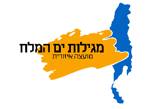 image by Dov Gutterman | 2:3    |
See also:
Usually known for short as Regional Council Megilot. The
northern part of the Dead Sea, which stretches from Moshav
Vered Yeriho to Kibbutz Mitzpeh Shalem, is a municipal
area managed by the this Regional Council.
The Council area covers four kibbutz's - Almog, Bet
HaAravah, Mitzpeh Shalem and Kalya – as well as Moshav
Vered Yeriho. Settlement of this region began with the
establishment of Kibbutz Kalya in 1974.
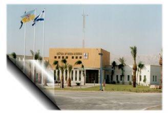
A blue over yellow bicolor charged with emblem (in a shield?) is
seen in front of the city hall at a photo at <www.dead-sea.org.il>.
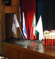
A white flag charged with the emblem is seen at another photo at the municipal site.
Dov Gutterman, 15 April 2005
Advertisement from our sponsor:
Bei Fahnenversand.de erhalten Sie eine Vielzahl an hochwertigen Flaggen, Pins und Aufnähern, zum Beispiel: