This page is part of an mirror of © FOTW Flags Of The World website
This website is devoted to the science of vexillology (the study of flags).
All illustrations presented on this website serve exclusively to provide information in the context of vexillology.
The authors and hosts of this site explicitly distance themselfes from any symbols of unconstitutional organizations that may be depicted here.
Last modified: 2025-10-11 by rob raeside
Keywords: qurluqtuq | kugluktuk | coppermine |
Links: FOTW homepage |
search |
disclaimer and copyright |
write us |
mirrors
![[Kuglugtuk, Nunavut Territory]](../images/c/ca-nu-kg.gif) image by Masao Okazaki, 12 September 2025
image by Masao Okazaki, 12 September 2025See also:
The flag of Kugluktuk can be seen on a photo here.
About Kugluktuk from Wikipedia: Kugluktuk, Nunavut
Kugluktuk (Inuinnaqtun: Qurluktuk, "the place of moving water"; Inuktitut: ᖁᕐᓗᖅᑐᖅ, formerly Coppermine until 1 January 1996) is a hamlet located at the mouth of the Coppermine River in the Kitikmeot Region of Nunavut, Canada, on Coronation Gulf, southwest of Victoria Island. It is the westernmost community in Nunavut, almost on the border with the Northwest Territories.
The traditional language of the area was Inuinnaqtun and is written using the Latin alphabet rather than the syllabics of the Inuktitut writing system. Like Cambridge Bay, Bathurst Inlet and Umingmaktok syllabics are rarely seen and used mainly by the Government of Nunavut.
Aleksandar Nemet, 22 February 2010
Photo from 2023: https://cdn.nunatsiaq.com
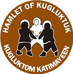
![[Kuglugtuk, Nunavut Territory (Canada) coat of arms]](../images/c/ca-nu-kg).gif) image by Masao Okazaki, 12 September 2025
image by Masao Okazaki, 12 September 2025
Source: https://www.kugluktuk.ca/Content/images/logo.png
Advertisement from our sponsor:
Bei Fahnenversand.de erhalten Sie eine Vielzahl an hochwertigen Flaggen, Pins und Aufnähern, zum Beispiel: